A solo winter expedition on the Canol Heritage Trail in northwestern Canada – supported by travellunch
The Canol Trail is a 355-kilometer trail between the Yukon Territory border and a small settlement in the Northwest Territories in Canada. Today, the Canol is one of the toughest trails in North America. Never before has this trail been skied in winter without support.
This was exactly the challenge I wanted to face.
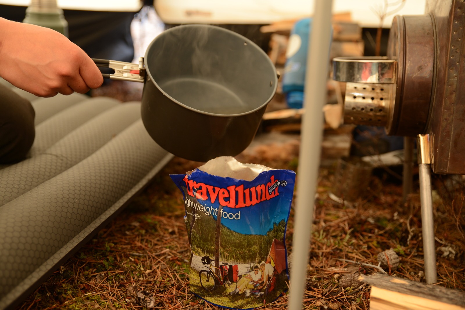
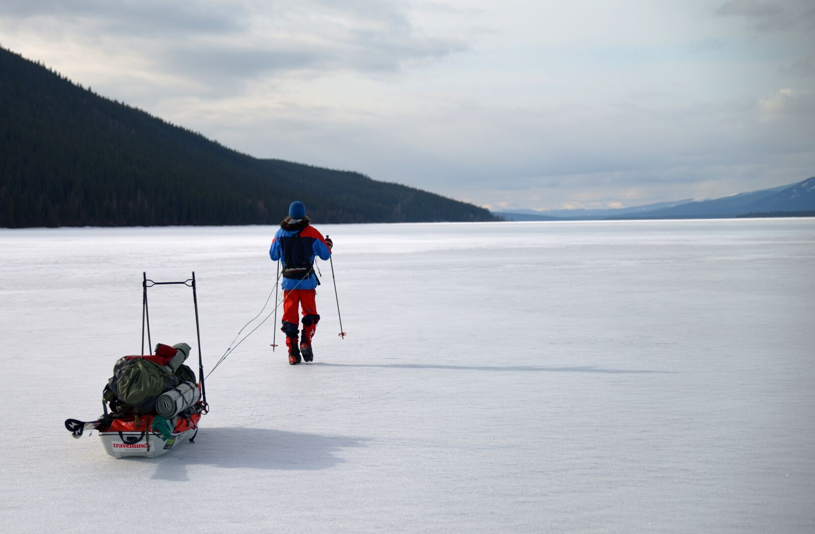
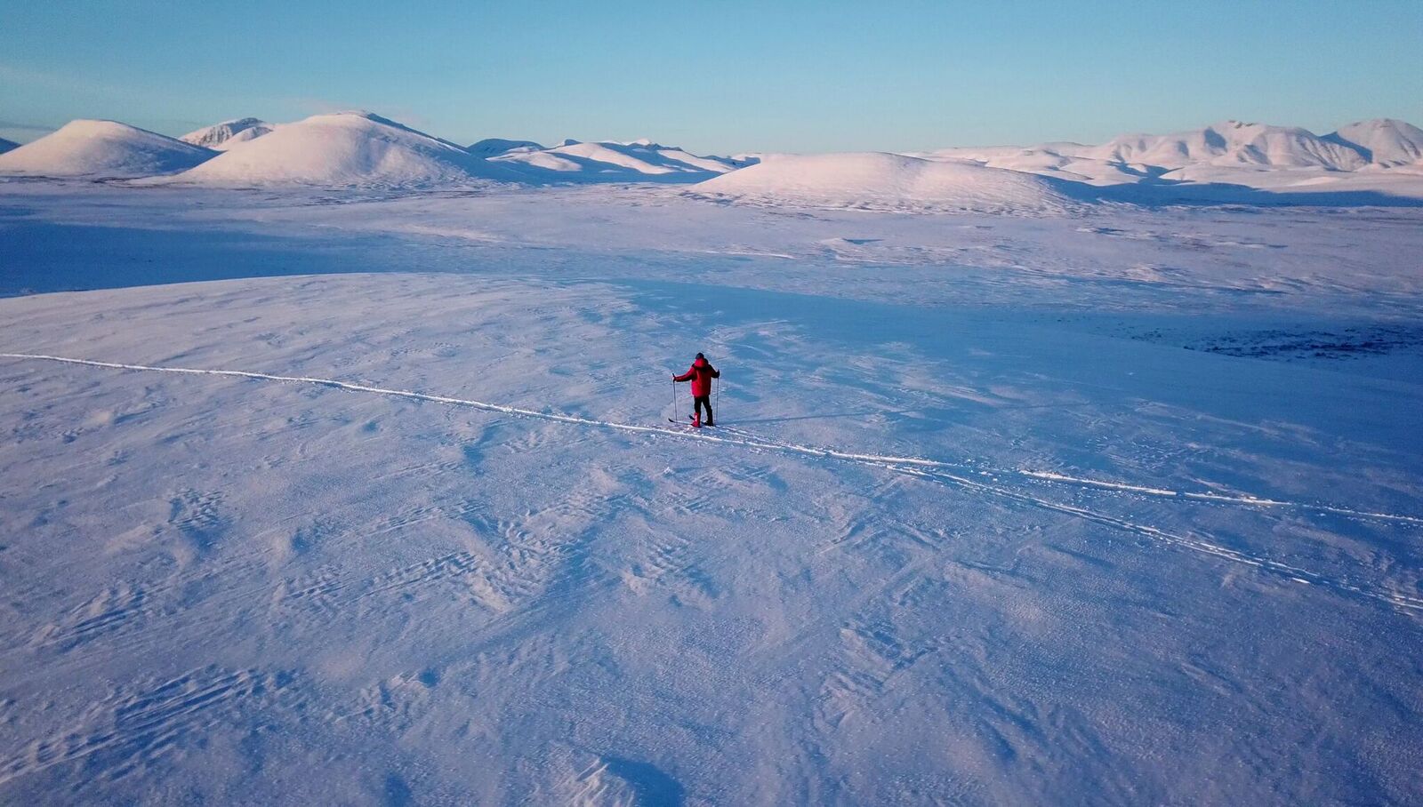
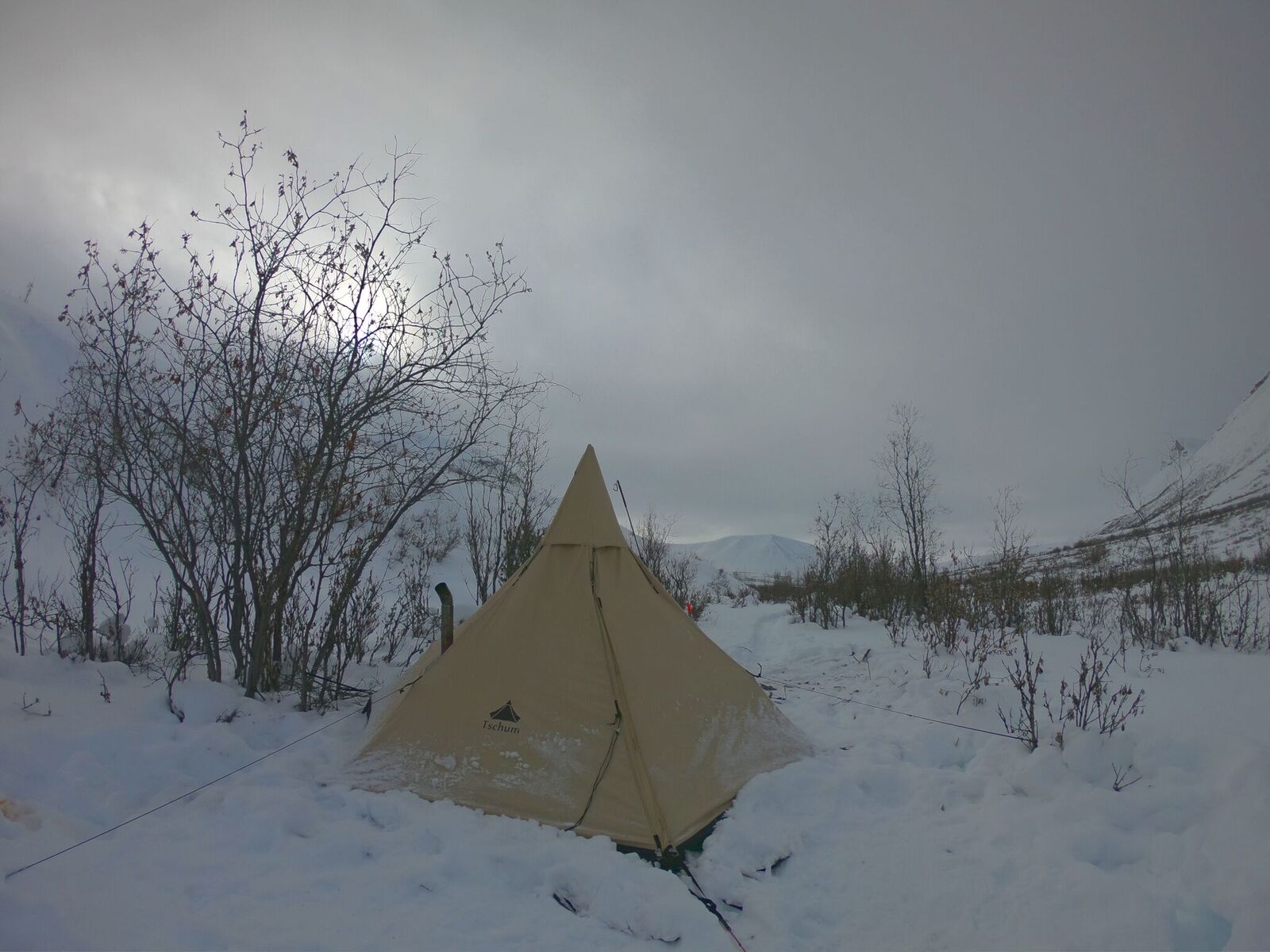
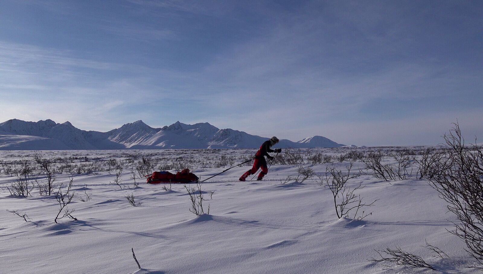
A small propeller plane took me to my starting point in the middle of the lonely Mackenzie Mountains. As the plane disappeared into the cloud-covered mountains, it suddenly became very quiet. Only the wind broke the still unfamiliar silence now and then. With a fully packed sled and my large backpack, I covered the first meters on the snowy path. It was not easy to move forward, and everything took its time. But meter by meter I made my way through the deep powder snow. The trail led me across the frozen Tichu River and meandered upward into the white mountains. With the up-coming ascents, the first difficulties lay ahead. It was almost impossible to pull the 100 kilos of equipment up the mountain while making a trail in the deep snow. After hours of grinding, it was clear that moving forward like this was impossible. I had no choice but to go ahead with a light pack, make a trail and go and get the pulk on the next day. Again and again the way led me over frozen rivers, lonely mountain passes and wind-blown plateaus. The nights were bitterly cold with temperatures of up to -38°C and there was not always wood for my small tent stove. In such an environment it was especially important to eat properly and sufficiently. Every evening the energy reserves had to be replenished. Dried meat, nuts with oil, and travellunch provided the necessary kilocalories.
After 17 days on the trail, suddenly engine noise penetrated the usual silence.
In the sky above me, I spotted a helicopter flying down the valley at high speed.
With a deafening noise, the blue monstrosity circled me, whirled the white ice crystals around and came in for a landing not far from me. The helicopter had come to this remote area because of me. I was almost certainly the only person within a 300-kilometer radius.
The daily “everything okay” message from my satellite emergency transmitter had been overdue for three days at this point. As usual, this important message had been sent by me every evening but had never reached the recipients at home in Germany. Until this day, I don’t know why the transmission failed. The message not coming through was reason enough for my friends to contact the Rockie Mountain Police. The local authorities from Norman Wells did not hesitate long and sent an officer with a helicopter to the last received GPS coordinates of the okay message. After only a few hours, I (supposedly the one in distress) was found.
My slow progress and the fact that a second rescue mission at a later stage would have my name on the bill forced me to stow my gear in the helicopter and take a bird’s eye view of the rest of the Canol Trail. I had to cancel my long-planned tour from one moment to the next.
After the initial disappointment had passed, I could not help but realize that the first few days alone had been worth all the trouble, worries and effort. The deeper goal of my expedition had not only been to get to a certain place, but the way to get there.
Report: Andreas Baeumler
Photos: Private