Alexander Huber was in Greenland in 2016 – here is the report:
Carpe Diem
Many years ago, two friends of mine, Hias Leitner and Alex Fidi, told me about this magnificent wall of the Tupilak in East Greenland. They first climbed the south wall 16 years ago and Hias was convinced that a free ascent wouldn’t be easy, but doable.
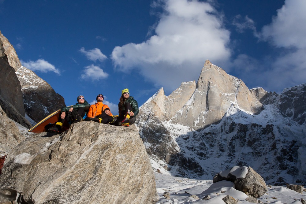
And when I was traveling the mountains of East Greenland last year together with Hubert von Goisern, this goal came back into focus. Just like the huge pillar on the Rytterknægten, perhaps the most prominent mountain in East Greenland. Enough reasons to set off for the arctic wilderness together with the East Tyroleans Bruno Schneider, Christian Zenz and Mario Walder.
Mario Walder describes our journey:
From information from expeditions 16 years ago we chose our destinations, and this one sentence from Alex Fidi’s report we will probably never forget….
“07/17/2000 Ski tour to the highest peak of Kulusuk”….
In early July, after a two-hour flight from Iceland, we arrive at the airport of the small island Kulusuk. The gateway to East Greenland. Unlike our friends who arrived here 16 years ago in the middle of July, there is no ski tour on the agenda here. At 20 plus degrees Celsius there is not a hint of snow.
But the weather is wonderful! With his boat an Inuit brings us to the last place called Sermiligaaq. Well equipped with touring skis and train sleds (pulks) we planned to take our gear across the Karale Glacier to Deep Freeze Pass and then on to the 16th Sept. glacier to ascend Tupilak. But the glaciers are bare to an unimaginable extent. No snow, no firn, the skis are the most useless piece of equipment of the expedition. They will not be of use until the end of the trip.
Due to the dragging on the bare ice, our pulks already start to break after only two days and we have barely made it one third of the way!!! Tired and a little frustrated, we decide to set up camp right at the base of the Rytterknægten. On the following two days we explore the possibilities, and it quickly becomes apparent that further progress on the softened glaciers is impossible. Glacier crevasses of incredible dimensions and even at higher altitudes barely any snow, temperatures above 20 degrees Celsius. No way…
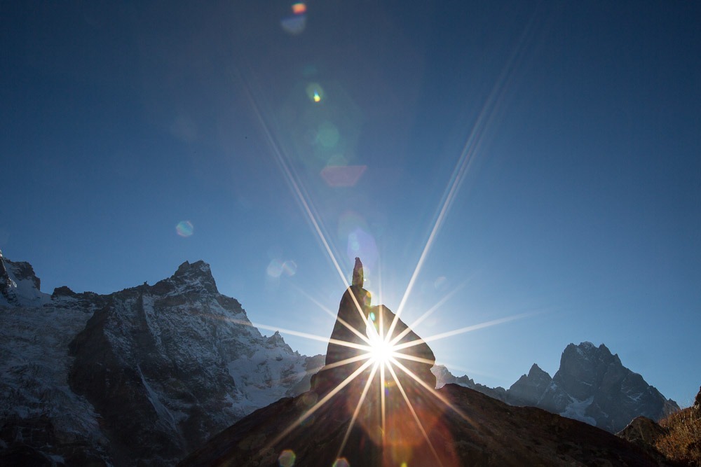
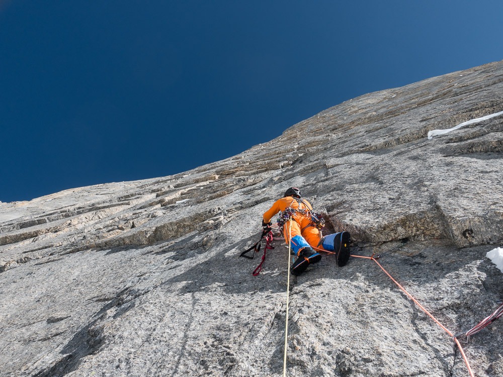
New plan… new chance… Alexander had already been in this area last winter. From the opposite summit he noticed the huge unclimbed east pillar of the Rytterknægten. In order to approach the pillar, there is only one reasonable path, which has many bends and is not visible from below. Based on the footage from the previous winter we explore and find the corridor and a few days later we set off at half past three in the morning. A good 900 meters of altitude up to a saddle, then 250m down again to the entrance. Over the wild protrusion up to the striking pillar. Finally, the ascent gets steep, and the rocks look really good! The climbing during the first eight pitches is just awesome at an approximate lower eighth degree of difficulty. Then a little rope-free ridge climbing to the next upswing, another two pitches in the steep granite and we reach the top of the pillar.
After a long day we melt snow and prepare for energy intake: travellunch, bacon, cheese, and bars. Without energy there’s no thrust! Well invigorated, we tackle the last steep summit towers. The only way is forward because a bivouac is not part of the plan! Why would it? In the arctic summer it doesn’t get dark, so we push on until we reach base camp. A few pitches on a brilliant ridge with wild towers take us to the summit. At 8 p.m., everyone is overjoyed standing at the highest point. The incredible atmosphere in the evening sun is a fitting reward for our efforts. But the descent over the very long north ridge still lies ahead. After seemingly eternal descending and abseiling we reach the glacier. A short labyrinth and another hour down to base camp. Upon arrival at the tent, I hear this annoying noise from my tent: the alarm clock is ringing again…J
Exactly 24 hours have passed, and a tremendous mountain trip is over. Everyone is healthy and overjoyed.
Region of
East Greenland, Schweizerland
Starting point:
Sermilgaaq, an Inuit village with about 200 inhabitants. The village is located on a fjord where large glaciers such as the Rasmussen and Karale glaciers calve, hence the name Sermiligaaq, which means “Where the icebergs come from”.
Mountain:
Rytterknægten, 2020m, in the heart of what is known as Schweizerland. Named after the Swiss geographers who first surveyed the mountains of the region around Tasiilaq, the capital of East Greenland.
First ascent in 1938 by a Swiss expedition (including Henry Dunant and André Roch) via the north ridge.